17 L.A. walks to catch up with Mom on Mother’s Day — or any day
- Share via
My mom loves to walk. She’ll walk for miles alone, but she’d really prefer to walk with one of her kids. Or better yet, one of her kids and her grandkids. She loves to push a stroller.
If your mom is also an avid walker — and would like nothing more than to spend time with you — consider taking her on a Mother’s Day stroll. Walking is great exercise, but it also sets the stage for chatting more deeply than, say, half-listening when she calls. Have you ever asked your mom about her favorite thing to do before becoming a mom, her own relationship with her parents or a memory from when you were growing up that makes her smile? Go somewhere new with Mom as you amble along.
Planning your weekend?
Stay up to date on the best things to do, see and eat in L.A.
These L.A.-area walks are curated from our previous guides, such as walks by the water, essential walks and best hikes. You won’t find your typical fare, like the Silver Lake Reservoir, Hollywood Reservoir, Griffith Park or the Huntington. All are great options for walkers, but I suspect they may be overly crowded on Mother’s Day.
— Brittany Levine Beckman

Amble along the L.A. river
Begin the walk at the beautifully landscaped Lewis MacAdams Riverfront Park, where the parking is plentiful. On a recent Sunday morning, I saw friends picnicking, a dad and his daughter practicing baseball and three young men in bright streetwear setting up a video camera. Asked what they were up to, they grinned and said, “You know, making content.”
Walk through the park toward the water and turn right when you hit the bike path. Almost immediately you’ll see a sandwich board on your right advertising Tadaa.Coffee x Happier Camper Cafe, a cheerful outdoor cafe with string lights and wooden cactus sculptures located at the Happier Camper headquarters. You can stop here, but don’t feel like you must. There’s an embarrassment of eating and drinking options along this route.
Further down the path you’ll come to Lingua Franca, an elegant riverside cafe serving New California cuisine. For something more casual, try Spoke Bicycle Cafe, where you can rent bikes and order sandwiches, salads or breakfast in a graffiti-filled outdoor courtyard. On Wednesday through Sunday, keep your eye out for another sandwich board advertising something called “Toad.” This leads to a meticulously curated gift store in a shipping container where you’ll find jewelry, crystals and Frogtown merch.
From the bike path, turn right on Newell Street where La Colombe Coffee Roasters’ modern cafe sits, then turn right on Blake Street. You’ll soon come to the pink vegan bakery Just What I Kneaded in a former machinists shop. Next door is the atmospheric Justine’s Wine Bar, a favorite gathering spot for local business owners. Just a few steps away, at the corner of Blake and Knox Avenue, Wax Paper makes excellent sandwiches named for NPR celebrities.
Keep going on Blake until you hit Coolidge and turn right. You’ll pass the high-end vintage boutique Singulier and Hot Spells Crystal Shop. You’ll have to double back along the bike path to return to Lewis MacAdams Riverfront Park, but by now you should have had all the caffeine, food and alcohol you might need. All that’s left to do is gaze at the flowing — or, depending on the season, trickling — river.
Architecture buffs will enjoy this largely flat hike
The trailhead starts at San Pascual Stables, but there’s a parking lot for hikers adjacent to the baseball fields; there’s also bountiful street parking.
It’s nearly impossible to get lost on this hike — most of the walk follows the concrete river basin. But there are a few, more remote trails that veer off from the main path, with densely planted trees and spots of shade. There are also benches, for a rest, along the way.
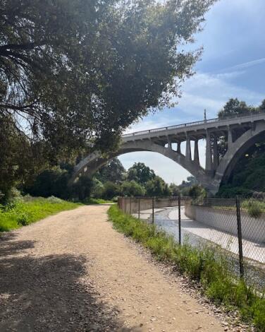
For a relatively straightforward hike, there’s a lot to hold your interest here. The trail passes an archery range in its second half, at which point the colorful, mounted targets are visible through the trees, as are archers wielding bow and arrow .
Walking under the great arches of the 1922 San Rafael Bridge and the 1914 La Loma Bridge adds a touch of drama to an otherwise facile and peaceful hike.
Spot turtles, herons and oak groves in this lesser-known park
Park at the Nature Center lot ($6 to $9) or outside of the lot. Entry by foot to the nature center is free. Directions to trailhead.
View iconic L.A. landmarks on this easy trail
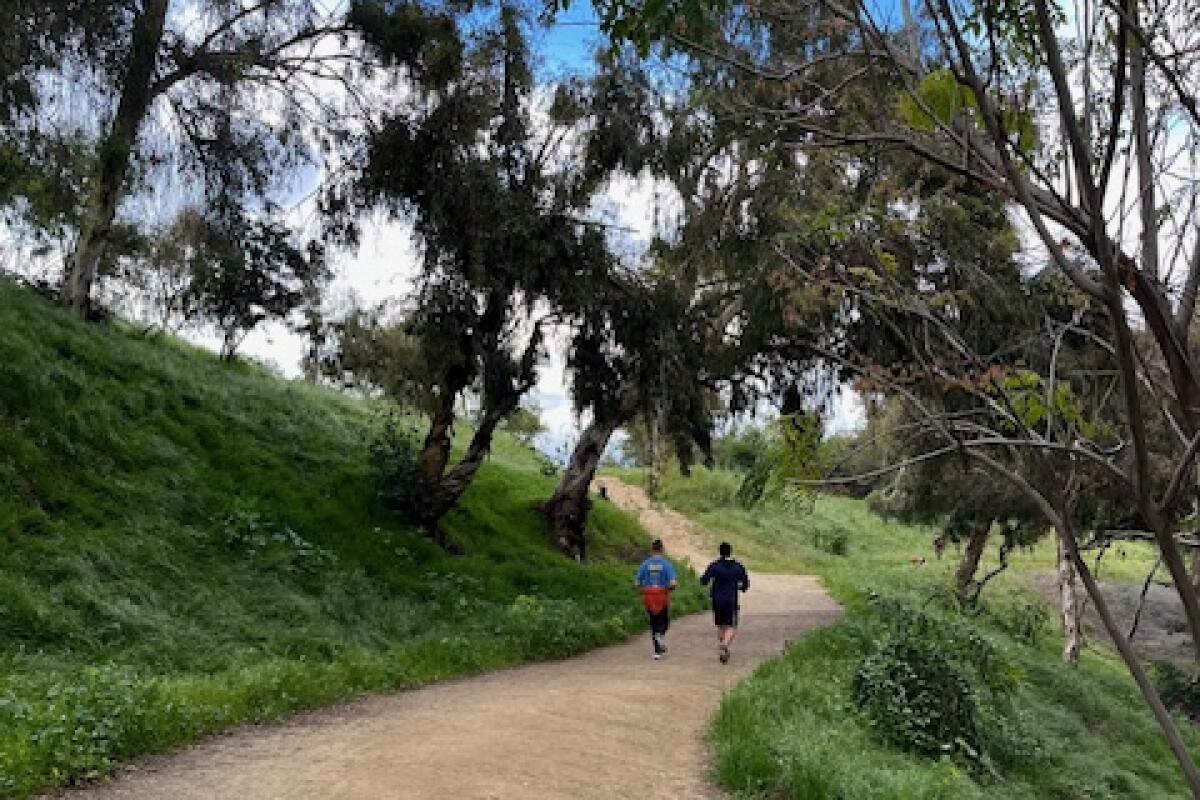
What is perhaps most charming about this hike is the commingling natural and urban elements. The sounds of sparrows, ravens and crows mix with Latino music from a nearby birthday picnic and intermittent cheers from a pickup soccer game in the park, for example. Meanwhile, the scent of fuchsia-flowered gooseberry, California wild rose and purple sage blend with wafting barbecue smoke.
The trailhead, off Stadium Way in Elysian Park — just minutes from downtown L.A. — is easily accessible and yet, as you wind around the cityscape, ensconced by coast live oaks, California walnut and spindly palm trees dotting the hilltop, you feel completely transported. This is why we live in L.A.

Explore rich cultural history on this street tour
Start your 2-mile walk at the historic Plaza del Mariachi de Los Angeles (a.k.a. Mariachi Plaza), where mariachi musicians have gathered for decades in search of gigs. The broad plaza‘s central kiosk was donated by the Mexican state of Jalisco in 1998, and is the site of community festivals and open-air markets. (It’s also popular with skateboarders.)
Heading south on 1st Street, you’ll see the glimmering House of Trophies on your right next to the vegan restaurant Un Solo Sol, whose fare includes mushroom tacos and banana date almond milkshakes. Across the street, look for Espacio 1839, a gallery and gift shop highlighting Mexican and Mexican American artists. (Its selection of bright leather tooled wallets is especially eye-catching.)
Continue to mosey down 1st Street and take in the neighborhood. I loved the old-school sign outside of La Casa del Musico, which has been selling musical instruments and supplies since 1978, and the bright mural outside the 1st Street Pool Hall. Just past Cummings Street, Botanica Olokun stocks an enormous array of spell candles as well as a cute selection of clothes, fake eyelashes and jewelry. On the same block is Al and Bea’s Mexican Food, a local staple since 1966, known for its deliciously dense burritos (the “combination” with bean, cheese, shredded beef and green chile is a favorite). If you continue past North Mathews Street, you’ll come to Otomisan Restaurant, the oldest Japanese restaurant in L.A., with just three booths and three seats at the counter. The small building originally housed a Japanese-owned grocery store in the 1920s and was converted to a restaurant in 1956.
To see more of the neighborhood, retrace your steps for two blocks and hang a right at Breed Street, passing the red brick Breed Street Shul on your way to Cesar E. Chavez Boulevard. Built in 1922, the synagogue dates to a time when Boyle Heights was home to the largest concentration of Jewish people west of Chicago. Turning left on Cesar Chavez, you’ll enter a bustling thoroughfare passing Las Fotos Project, a nonprofit dedicated to mentoring young women of color in photography, and the beloved nursery LatinX With Plants, which hosts workshops and has an excellent selection of greenery. The first Guisados to open in L.A. is on the corner of North St. Louis Street. Also note the El Norteno and de Savy Store across St. Louis. One half of the storefront specializes in western wear, the other in Yu-Gi-Oh trading cards. Definitely don’t miss Other Books, an overstuffed but well-organized bookstore that sells both used and new books, as well as an impressive selection of comics and zines.
To get back to Mariachi Plaza turn left on North Cummings Street and right on 1st Street again. You’ve been here before, but that’s OK. The community’s authenticity and rich history makes every part of this walk worthwhile, even the parts you’ll do twice.
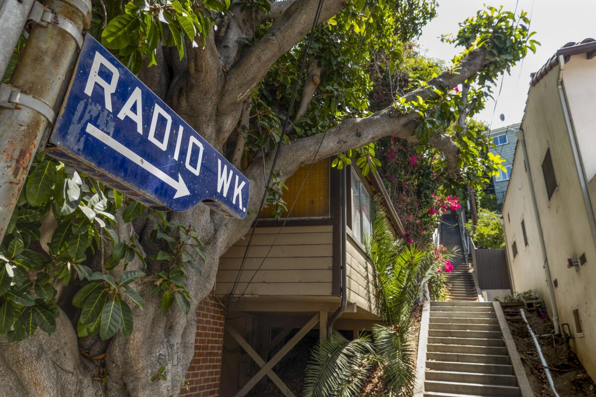
See eye-popping architecture on this stair-heavy walk
There are fewer than 700 steps on this walk, but it still has some breathtaking climbs and drops.
1. Fleming starts this walk at the nightmare triple intersection of Hollywood Boulevard, Sunset Boulevard and Hillhurst Avenue. I recommend doing anything you can to avoid that, such as parking on a nearby residential street like Rosalia Road (where I parked) or North Commonwealth Avenue, both of which connect to Sunset Drive, where we will start our walk heading east.
2. Be sure you walk on Sunset Drive — not Sunset Boulevard — toward the hills, which, yes, we are going to climb.
3. Walk past Rosalia Road and North Commonwealth Avenue on Sunset, and turn left on Hoover Street.
4. Walk two blocks up Hoover, past Clayton Avenue (jog a little to the right to stay on Hoover) and West Camero Avenue to where the street ends in front of the Hoover Walk, a double-sided staircase with a colorful and slightly graffitied mural. We had to step over a small smoldering fire of dried leaves someone started on the eighth step, but we made it to the top — 38 steps total — otherwise unscathed.
5. Now you’re on Prospect Avenue. Turn right and walk past Talmadge Avenue, with the Prospect Studios on your left. This is a historic Hollywood production facility, initially the home of Vitagraph Studios in 1915 until it was purchased by Warner Bros. in 1925, where they made many movies, including the first talkie, “The Jazz Singer.” ABC purchased the facility in 1948 and it became home to many popular television shows, including “Grey’s Anatomy.” The studio now is owned by Walt Disney Co., which acquired ABC in 1995.
6. Keep walking on Prospect past Myra and Sanborn avenues. The road will start climbing; just past 3976 Prospect, as the road curves left into a blind curve, look for your next set of stairs to the right — the Prospect Walk.
7. These stairs go up 57 steps, without handrails, to Deloz Avenue. Cross the street and continue up another 71 rail-less steps to Hollyvista Avenue. Cross that street and take a deep breath for the final stage — 168 steps up to Franklin Avenue, the top of Franklin Hills.
8. As you catch your breath at the top, look to your right to admire the lovely home with the two-masted boat etched on its chimney and yards with great succulent/cactus landscaping. Then turn left on Franklin and head downhill.
9. When the road begins turning to the right toward Radio Street, look to your left for the Radio Walk staircase. There are some lovely views here at the top of Hollywood, Century City and the Sunset Strip. But now you must begin your descent, which comes in two stages, first 127 steps back down to Hollyvista and then across the street another 97 steps down to Deloz.
10. Turn right on Deloz for just a few steps and then bear left onto Melbourne Avenue (the sign is well hidden by the surrounding trees). Follow Melbourne as it bends to the right, past the playing fields of the Lycée International de Los Angeles (a bilingual French-English K-12 school) and the Norman Harriton Community Garden of Franklin Hills on the left. There are some lovely homes through here, but note the profusion of signs warning about security cameras — a common feature on almost all of my stair walks.
11. As Melbourne curves, it becomes Sanborn Avenue, and at the end is the next step of stairs, 85 wide steps up to Franklin Avenue.
12. This is a busy three-way intersection, with lots of traffic merging onto Franklin from St. George Street directly in front of you. If you have time, take a short detour to the magical Shakespeare Bridge to your left, where you can take photos through the crazy turrets and stare down at the wild garden below, but walk carefully because the sidewalks are narrow. We opted to gaze from a distance and then continued our walk by turning right on Franklin. We crossed to be on the sidewalk, heading uphill, but the sidewalk disappeared after a few houses, so it’s back to street walking, but here, where the road curves up to the right, the traffic isn’t as fierce.
13. Bear right past 3959 heading onto Hollyvista as it winds downhill.
14. Bear right again onto Deloz, passing the Radio Walk steps on your left (unless you want a super workout, in which case you can run up the Radio Walk steps, turn right on Franklin and walk about a block, then run down the Prospect Walk steps to rejoin the walk).
15. If you opt for the sane-and-sensible route, walk straight on Deloz, up and over a small rise, past the Prospect Walk and Hollyvista.
16. When you reach Clayton Avenue, take a moment to admire the Hansel-and-Gretel-style house at the corner and then turn right, heading downhill. As the road winds down, look to the right for some great views of Griffith Observatory and the Hollywood sign, but keep an eye out for traffic since Clayton is another winding, narrow street without sidewalks.
17. Just after Clayton makes a big bend to the right, look to your left for your final staircase under a massive sprawling pine. This is a short climb of 41 steps to the cul-de-sac end of Sanborn Avenue.
18. Walk straight on Sanborn until you reach Cumberland Avenue. Turn right and walk down a very steep hill, past Myra, where the road thankfully flattens and begins a small climb for a block until you reach Talmadge Street and turn left.
19. Walk a short block on Talmadge to Sunset Drive, where you turn right and return to your car.
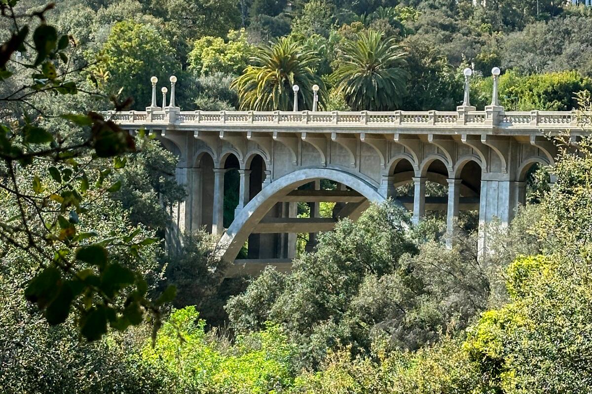
Take a tree-lined stroll to a neoclassical bridge
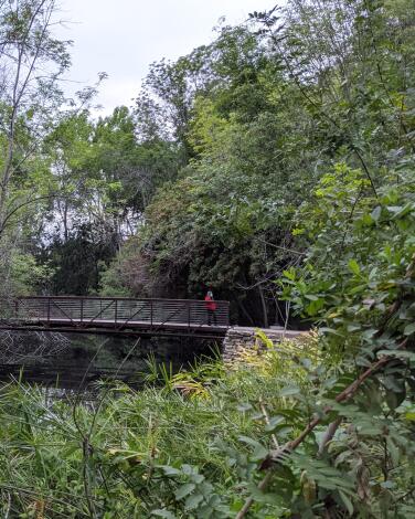
It’s also perfect for a 1.3-mile loop that takes you along both sides of the arroyo, up across the bridge itself and back again. For easy parking, start at the Lower Arroyo Park Area. Cross the arroyo on the small footbridge near the northern end of the parking lot, and then take a left to follow the Arroyo Seco Trail south along the western bank of the channel. If you want some free entertainment with your walk, come on Sunday mornings when the Pasadena Roving Archers use this spot for their weekly competition. (Kids in particular might get a kick out of watching the arrows fly — from a safe distance of course.)
As you head down the tree-lined arroyo, you’ll catch your first glimpses of La Loma connecting the two sides of the ravine. A few yards upstream from the bridge, you’ll find the footpath that leads up to street level and onto the bridge itself, where you can check out its pretty railings and impressive (though not original) lampposts. When you reach the east side of the arroyo, turn right and walk along South Arroyo Boulevard for a minute until you find stone steps leading back down into the ravine. Follow the path north to your starting point, enjoying views of the Colorado Street Bridge and the San Gabriel Mountains upstream.
Hours: Monday-Sunday, dawn to dusk.
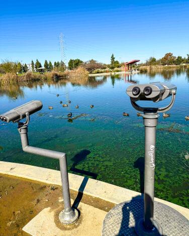
Bring your bird-obsessed mom on this leisurely walk
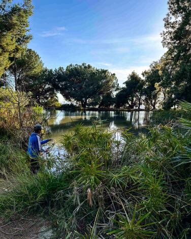
A leisurely 1.3-mile walk around this attraction-stuffed park will lead you by a playground and through open fields, passing workout stations and a large rec center. But the park’s crown jewels are a pair of photogenic artificial lakes connected by a rocky, trickling stream. A smoothly paved path laces around the shoreline, offering peeks into the tall reeds that circle the waters.
This is a bird-watcher’s paradise, with mounted binoculars available to help you get an even closer look at all the fowl behavior. On my last visit, I spotted at least 10 species, including one snowy egret and enough waddling geese to cause a brief traffic jam on the walking path. Give yourself at least a half an hour to enjoy a full tour around the park, although there are plenty of benches to beckon you for a longer stay. If you’re as lucky as I was on a recent weekend, there might even be an ice cream truck waiting in the parking lot when you’re done.

Head up and down hills with a stop at an artsy little library
This neighborhood stroll is a choose-your-own-adventure of ups and downs. Winding roads like San Rafael and Moon avenues offer calf-burning climbs and breezy descents. As you navigate the eclectic mix of Craftsman bungalows and more modern abodes, each turn reveals a new perspective on architectural styles or the sprawling cityscape below.
On one of these residential streets, you’ll encounter a tucked-away Little Free Library that’s as much a work of art as it is a book exchange. This literary outpost stands out with its vibrant tile mosaic, a colorful beacon for book lovers and art enthusiasts alike. It sits in front of Casa De Mi Sueño, a cultural heritage site believed to be built by Sophie Cubbison, whose cookbooks occasionally make their way into the library’s collection as a nod to local history.
My haul: I didn’t have anything to drop off (and didn’t take anything, either), but my walking pal grabbed “The Buried Giant” by Kazuo Ishiguro.
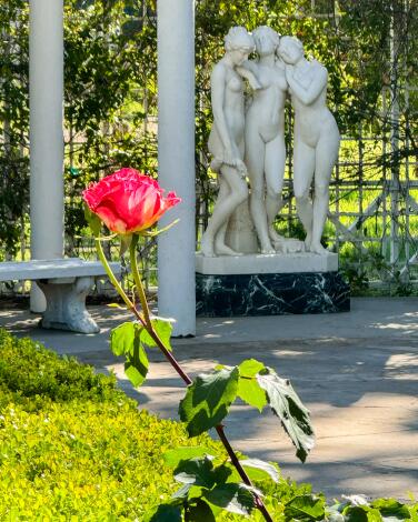
Stop and smell more than 400 rose bushes
But for pyrotechnic beauty, nothing beats the rose garden, bursting with red and orange blooms. More than 400 rose bushes — some about 100 years old — grow here, including trees and climbing varieties. The most historic are the ones on the east side of the adobe house — a patch of fragrant, strawberries-and-cream-colored Double Delights that were planted by Mary herself, who wanted to be able to see them from the nearby window of her office. Mary was one of the original members of the West Valley Garden Club, whose volunteers still work in the gardens today. “I think of this place as a hidden gem,” Yvonne Jones, a Garden Club member, told me on a recent visit. “It’s so quiet and serene. I come here almost every day, just to walk.”
Orcutt Ranch isn’t off the radar when it comes to weddings, though. In the summer, there’s an event almost every Friday, Saturday and Sunday evening. For a more peaceful visit, come in the morning or during the week. You never need a reservation, and admission is free. Dogs are welcome, but be sure to keep them on leash since coyote sightings are possible.
Hours: Open daily, dawn to dusk.
Admission: Free.
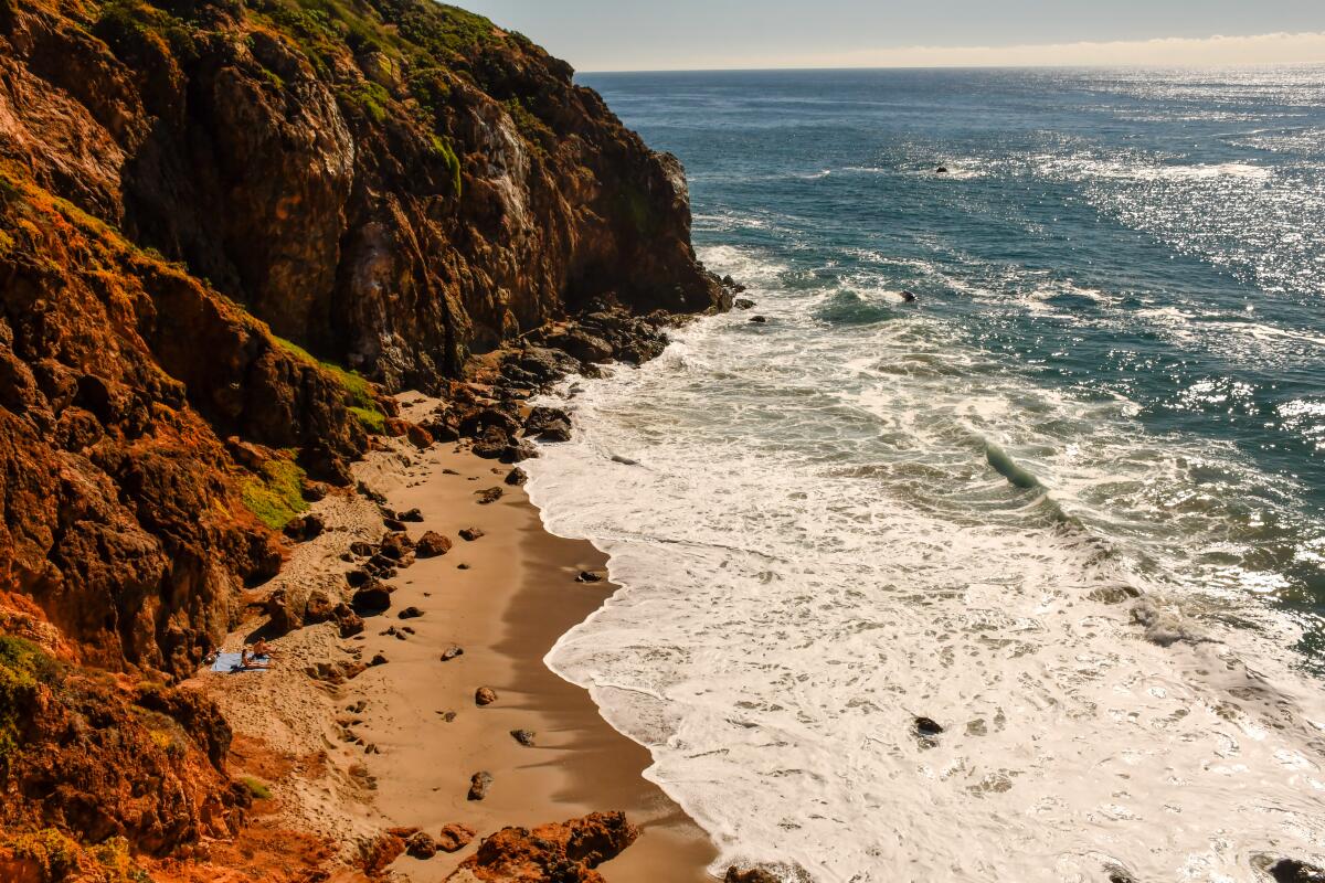
Breathe in the fresh ocean air with Mom
I showed up on a brisk day ideal for a beach walk, and there were dozens of us on the paths. I can picture some nasty foot traffic in the hour before sunset, but I can’t imagine a better place to stand and scan the sea for gray whales, which are common from February through April.
You get a wide view of Santa Monica Bay from the point’s high ground or the 200-yard boardwalk near the top of the hill. As a plaque notes, Point Dume got its name from English explorer George Vancouver, who sailed by in 1793 and attempted to name it for Francisco Dumetz, a Franciscan priest at the Ventura mission, and apparently left out the “tz.”
Northwest of the high point, follow the main trail to a rocky promontory that looks down on Pirate’s Cove Beach and a jumble of black rocks and tide pools. To your right, the broad, sandy expanse of Point Dume State Beach reaches northwest and blends into Zuma Beach.
I covered the network of paths at the point in about 90 minutes (with plenty of time for photography). You can add more steps by strolling north up the beach toward Zuma and doubling back . It’s all flat sand.
Tip: To start at the beach, take Malibu’s Westward Beach Road to Birdview Avenue, then park at Point Dume State Beach. To start atop the bluffs, head for the 29200 block of West Cliffside Drive where there are 10 two-hour parking spots. If they’re full, continue to Grasswood Avenue, turn left and look for street parking once it’s legal.
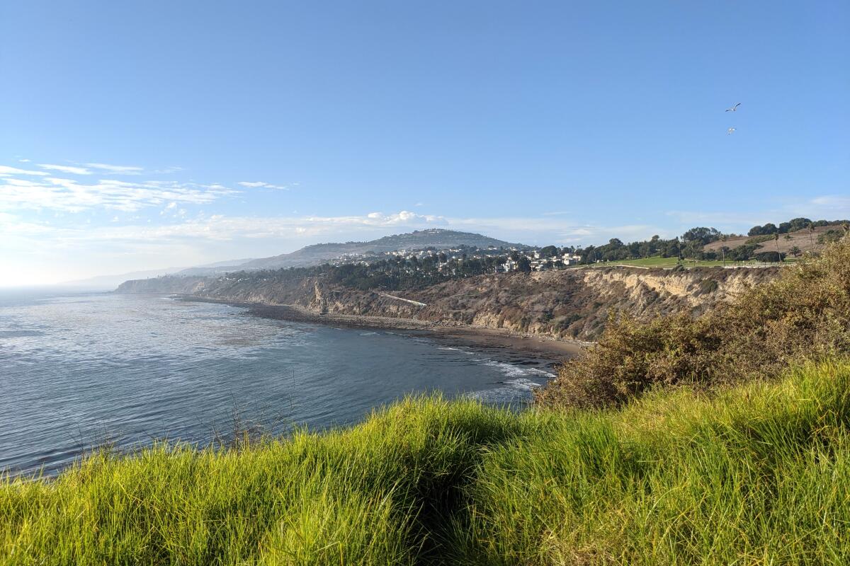
Awe-inspiring views await on this San Pedro hike
Park on the street at the southeastern end of Paseo del Mar Drive. Directions to trailhead.

Climb staircases at the beach
Here’s how to get there:
1. Begin your walk next to Bubba Gump Shrimp Company on the Santa Monica Pier. Near the southern corner of the restaurant, you’ll find your first staircase. Head down these steps and then bear right along the wooden path around the restaurant. Turn left onto the multiuse pathway, taking care to walk in the lane designated for pedestrians.
2. Follow the path around the parking lot until you notice a tremendous pedestrian overpass to your right. Head toward that bridge and take 42 steps up to cross over Pacific Coast Highway. But, you’re not done. At the end of the bridge, continue up 44 more stairs, appreciating the bluffs and probably a few squirrels. Bear left, past the cannon, onto the walking path through this portion of Palisades Park. Head westerly toward Arizona Avenue. Regardless of how cute they are, refrain from feeding the squirrels.
3. Near Arizona Avenue, bear left onto your next staircase. These 75 steps will take you down to a pedestrian overpass to cross over PCH again. Take the 36 steps down from the bridge to street level. You’ll turn left and then another immediate left through a parking lot, walking to the pedestrian path that meanders along the beach. Head northwest, past Perry’s Cafe, following the Ocean Front Walk as it veers left. Turn right at the next Perry’s Cafe, near bike racks, two benches and, next to the building, a small group of palm trees. Head northeast through the parking lot.
4. Head up the circular walkway that resembles a half pretzel from an aerial view. You’ll take the overpass onto the California Incline walking path, marveling at the wonders of modern architecture. Bear right toward the next set of trails, a winding set of 42 stairs. On the ramp, pause to take in the views, and maybe even snap a photo with the ocean behind you. At the top, head left through the park, popping into the public restroom if needed.
5. Near Montana Avenue, you’ll find your next set of stairs (and perhaps a local fruit vendor). Bear left onto this old wooden structure and descend 133 steps. Continue over the pedestrian bridge and down the spiral set of stairs to beach level.
6. Cross through the parking lot, and head toward the beach path. At this point, you have a few options: You can turn right and walk as far as you’d like down the beach. Maybe even jump into the glorious ocean. Or turn left and meander back to your car. There are multiple food and snack options along the way.

See where celebrities live like the rest of us
Start at the corner of Ventura Boulevard and Radford Avenue, grabbing a coffee from Blue Bottle if you need a caffeine fix (and to justify parking in this lot). This part of Ventura is known as sushi row because of its high concentration of raw-fish restaurants. For a brief tour, walk out of the parking lot and turn right on Ventura Boulevard heading southeast toward Carpenter Avenue. There are three essential spots on this block. The first you’ll pass is Teru Sushi, which opened in 1979, putting it at the forefront of the ’80s sushi craze. A few steps away, on the other side of the neighborhood watering hole Laurel Tavern, you’ll see Kiwami by Katsu-Ya, master sushi chef Katsuya Uechi’s second restaurant on Ventura Boulevard. (He opened his flagship Katsu-Ya a block away on Colfax Avenue in 1997.) Cross Ventura Boulevard at Carpenter and head back the way you came. On your right you’ll pass the two-Michelin-starred Asanebo, which opened in 1991.
Cross Radford Avenue and veer right onto Ventura Place, where there’s a popular farmers market on Sundays. Just past the fine food store Joan’s on Third, keep an eye out for Greenwood Shop, a colorful gift boutique selling locally made pottery and jewelry as well as a wide selection of candles, incense and plants. Pass the Alfred’s Coffee on your right, turn left on Laurel Canyon Boulevard and then right on Ventura Boulevard. It’s worth popping into the Barnes & Noble in a former 1938 movie theater, where you’ll encounter the original ticketing booth outside and enlarged book covers in lieu of movie posters. To see some of the residential neighborhood, continue down the block, turning left on Vantage Avenue past Uncle Paulie’s Deli and right on tree-lined Cantura Street where the front yards are filled with roses and white fences. Take a right on Laurel Grove Avenue and head back to where you started along Ventura Boulevard, passing another shopping area with record and clothing stores as well as the old-school Art’s Delicatessen with its checkerboard-tile storefront. It’s been here since 1957 and it too offers no shortage of delicacies.

Snack and stroll through downtown and Chinatown
The journey begins at the Broadway entrance of Grand Central Market, where you can grab a bite from one of many tasty food vendors (Sticky Rice is my go-to). After you’re sated, head north on Broadway toward 3rd Street. Continue toward 2nd Street, passing some newly opened art galleries on the left and the former L.A. Times building on the right, until you find yourself at Gloria Molina Grand Park. (My family calls it “the pink park” because of the hot pink benches and tables.) It has a terrific playground and a great view of City Hall.
If it’s a weekday, consider going into City Hall to visit the observation deck on the 27th floor. (It’s free, but closed on weekends.) Otherwise continue on, turning right when you hit West Temple Street and left when you hit Main Street. You’ll walk over the 101 Freeway — not the most beautiful scenery, but is anything more L.A.? — then keep an eye out for the three-story Pico House on your right. Completed in 1870, it’s one of the oldest buildings in downtown. Across the street is LA Plaza de Cultura y Artes, a hub of Latinx culture. Take the entrance to Olvera Street on your right and walk through the historic Mexican-themed marketplace that’s been a favorite with tourists since the 1930s. You’ll pop out on the corner of Alameda and Cesar E. Chavez, where you can try a taquito at Cielito Lindo (founded in 1934), or cross the street for a French dip sandwich at Philippe the Original (established in 1908).
Continue on Alameda Street beneath the elevated Chinatown Metro stop until you hit your final destination: Los Angeles State Historic Park. Opened in 2017, it’s an unexpectedly bucolic 32-acre spot that hosts a farmers market Thursdays from 3 to 7:30 p.m. There you can meander around the gentle curving paths, walking over small wooden bridges and taking in a scenic view of the downtown skyline, or cross the street to get a beer at Highland Park Brewery. When you’re done, you can either retrace your steps or take the Gold Line to the Historic Broadway Station. You’ll be right back where you started!
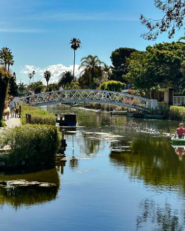
Channel that you're in another Venice
Parking around the canals can be rough, especially on summer weekends. For street spots, your best bets are nearby Ocean Avenue or 28th Avenue. Among the paid lots nearby, the city-run beach parking area at the end of South Venice Boulevard is often cheaper than the lots further inland.
Once you’re walking on the canals, beach traffic fades into a tranquil, park-like atmosphere, where pedestrians rule and the local ducks have their own private playground (the aptly named Venice Canals Duck Park, on Linnie Canal at Dell Avenue). The architecture here is like a microcosm of L.A. itself, with colonial cottages and Italian villas lined up next to glass-walled modern designs. Gardens along the sidewalks are lushly landscaped with succulents and fruit trees, and each wood-and-steel arch bridge seems to make for a better photo op than the last. In all my years visiting, I’ve never once seen a local using one of the many pretty rowboats tied along the canals.
On a recent walk, I clocked 1.2 miles in a curlicue path, although it would take even longer to explore every inch of the interconnected islands. For a treat at the end (or the beginning), grab a coffee or sandwich in the peaceful, bougainvillea-lined courtyard of the Canal Market (600 Mildred Ave.). Or plan your visit for a Friday morning, when the Venice Farmers Market pops up just across South Venice Boulevard.
Starting point: The Canal Market
Hours: 8 a.m.-7 p.m. Sunday-Wednesday, 8 a.m.-8 p.m. Thursday-Saturday
Sign up for The Wild
We’ll help you find the best places to hike, bike and run, as well as the perfect silent spots for meditation and yoga.
You may occasionally receive promotional content from the Los Angeles Times.
